Using good landscape design software aids communication between designer and client. It matches the ideas and aspirations of clients to what a skilled, experienced designer knows is possible. Design efficiently with the involvement of the client. There is no need to fear being asked by a client for a redesign.
“A garden is a place to live and share. A lawn, surrounded by cedar hedges or laurel belongs to the past. Lawns are water-intensive and require regular maintenance and so are minimized. Today, outdoor spaces must be treated as those inside – carefully and thoughtfully. Hedges and screening become places of life. Life moves, and the garden brings colour, volume and fragrances to become a place to live and escape the pressures of life. – Sylvie Bion”
A landscape designer needs to be many things – part artist, part botanist, part photographer, horticulturist. They need to be able to ‘sell’ themselves and effectively convey their ideas to a client. Traditionally, this was done by hand drafting plans, but landscape design software can now be used. Especially on large projects, much time can be saved using computer-aided software (CAD).
An example
The figure below shows a concept plan for the development of a hobby farm using landscape design software. The base information including contour information was developed from Google Earth data. A site visit was not needed as the data collected from Google Earth together with photos supplied by the client was accurate enough for the concept plan without the need for a site visit.
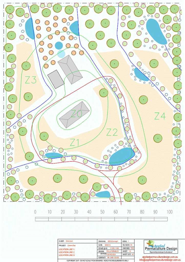
Comparing hand drafting to CAD drafting
The use of modern computer software has revolutionized the way in which landscape plans are developed. Not only can landscape design software deliver a classic design plan with a border and site details, plotted to a scale in double quick time, but the plan can include images illustrating design concepts and accurate counts of the type and number of species used in the design. Not only can plant schedules be created and automatically updated when changes are made, but any ‘hardscape’ symbol (such as a group of outdoor furniture symbols) can also have extended information attached to it [e.g. manufacturer details].
Typically, plans will include some or all of the following: location of ‘hardscape’ elements – paths, decking, ponds, drainage network, water storage, lighting, etc., soft landscape elements – planting, a plant species schedule with a number of each species required, site location, north point, scale indicators, general notes, etc. The figure below shows a typical CAD landscape plan for a constructed wetland.
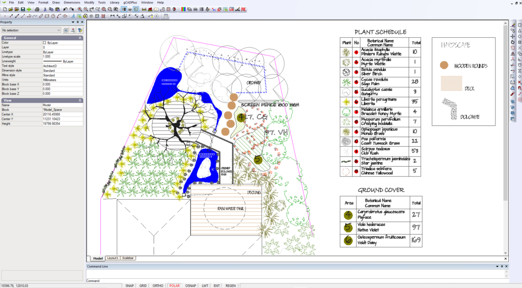
This type of plan could be drafted either by hand or with CAD software. However, it’s our belief that where projects become relatively complex and clients request more information than can be supplied on a single sheet, then CAD drafting is far more efficient than hand drafting.
- From one CAD model, many sheets can be produced showing accurate dimension details, photos of species specified in the plan, 3D Models, sun path, etc.
- A major benefit when using CAD software is that plans can be printed to PDF and emailed to clients.
- These PDF plans can be printed at different resolutions – low for quick distribution across the net, high for finished printed versions for the client.
- CAD software uses layers. This allows different layer on/off combinations can be applied to layout sheets.
- It is easy to incorporate images into your designs.
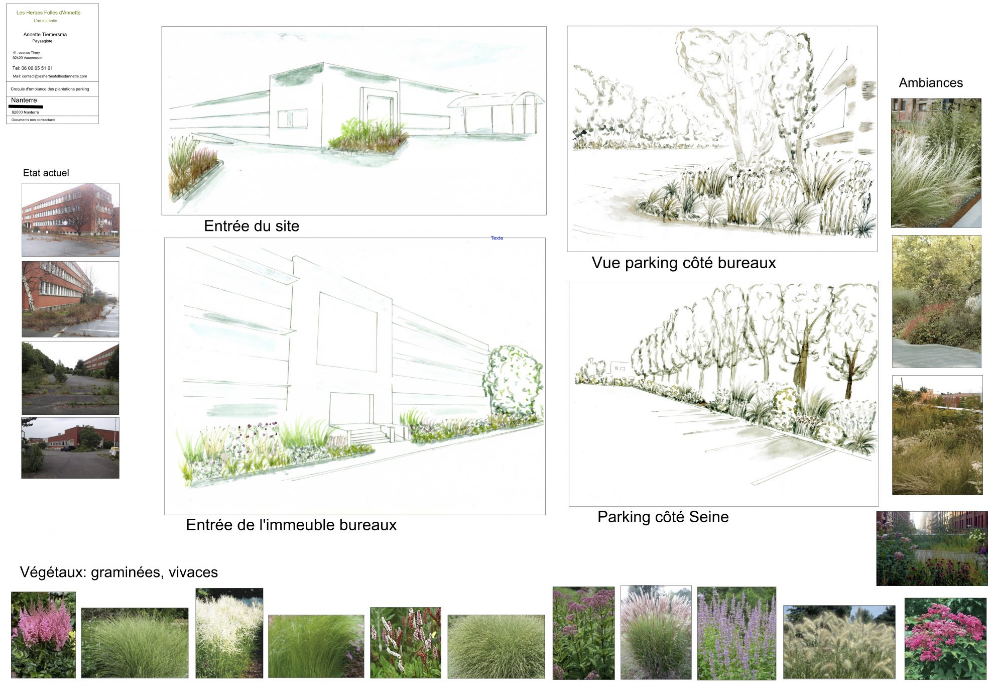
So in summary, a CAD drawing is much more than a replacement for a paper plan. The client gets an accurate rendition of what changes are intended for a site, is provided with multiple and detailed sheets containing accurate dimensions, and set out data such that the design can be implemented by any competent construction team without too much referral to the designer. With a small amount of extra effort, these CAD drawings can even have an organic ‘hand drawn’ feel. Producing plans with CAD software has a very real benefit for the client because the design can be emailed to a client to view your work. We know designers who carry out the whole design process while on site. They then email the drawing to the client while on their journey back to base. The process is fully digital, with a concomitant saving of time, energy, and paper.
Use previous work
Landscape design software also provides an opportunity to leverage past design work. Sections of paste designs can be lifted out and pasted into new work. This is especially useful when it comes to construction details.
Imperial (USA) vs. metric
Most CAD software vendors provide both metric and imperial versions. The figure below is a design for a front entrance for a house in Fort Lauderdale, Florida USA developed by the team at ‘The GreenMan Landscape Designers’ using gCADPlus landscape design software with decimal feet as the base drawing unit. Dimensions for laying out the design by a construction team are taken directly from the CAD software model. These can be displayed in the form of feet and inches.
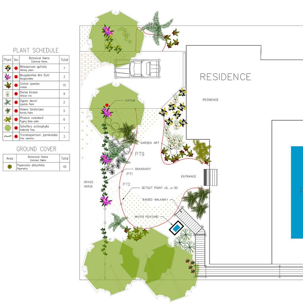
An example of some design work in the metric environment. The inclusion of photos of species used certainly helps clients.
Mix and match – using 2D and 3D models
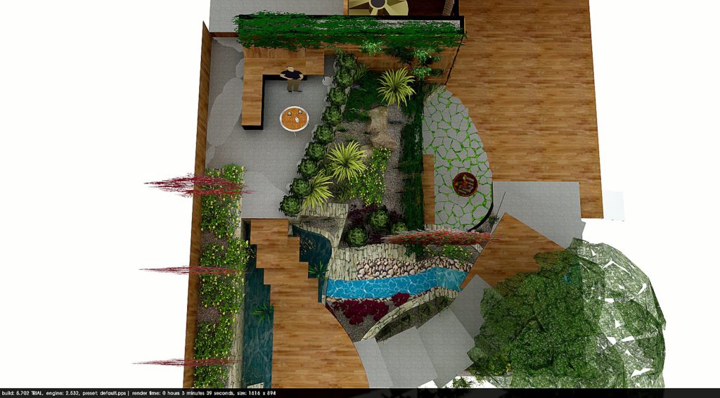
Instead of meeting with clients over hand-drawn plans and struggling to help interpret the design, it is now possible to deliver 3D models that allow the client to “walk-though” the newly designed space. The process might start with a 2D plan then pass to another 3D application such as SketchUp and a 3D model created. The SketchUp model might then be rendered in another application (Kerkythea) for adding lighting rendering. A final step might be to animate the scene. Some designers are then publishing the final animation as a YouTube movie.
Learn more about landscape design.