In many instances, satellite data from sources such as Google Maps and Google Earth can be used to obtain a base map suitable for landscape design. It is relatively simple to save an image from Google Maps, import the image into Landscape CAD software such as gCADPlus, scale it and develop landscape designs onto the scaled image. It is more difficult to capture an image from Google Earth and extract 3D information and develop contours for subsequent design work. Here both approaches are discussed.
Capture an image from Google Maps
![]() Here is a small movie showing how to capture a high-resolution site view. The figure below shows an example of a captured image in gCADPlus. The next task is to scale the image so inquiries using the distance command yield accurate answers.
Here is a small movie showing how to capture a high-resolution site view. The figure below shows an example of a captured image in gCADPlus. The next task is to scale the image so inquiries using the distance command yield accurate answers.
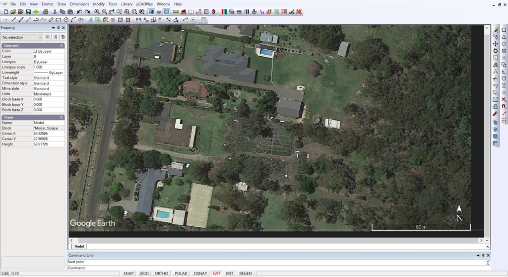
Tip: We suggest that you start by selecting the image and scale it by 1000. In this particular instance, the scale bar then read 27602 and we require it to read 80,000 units so we next scale the image by 80000/27602 = 2.891.
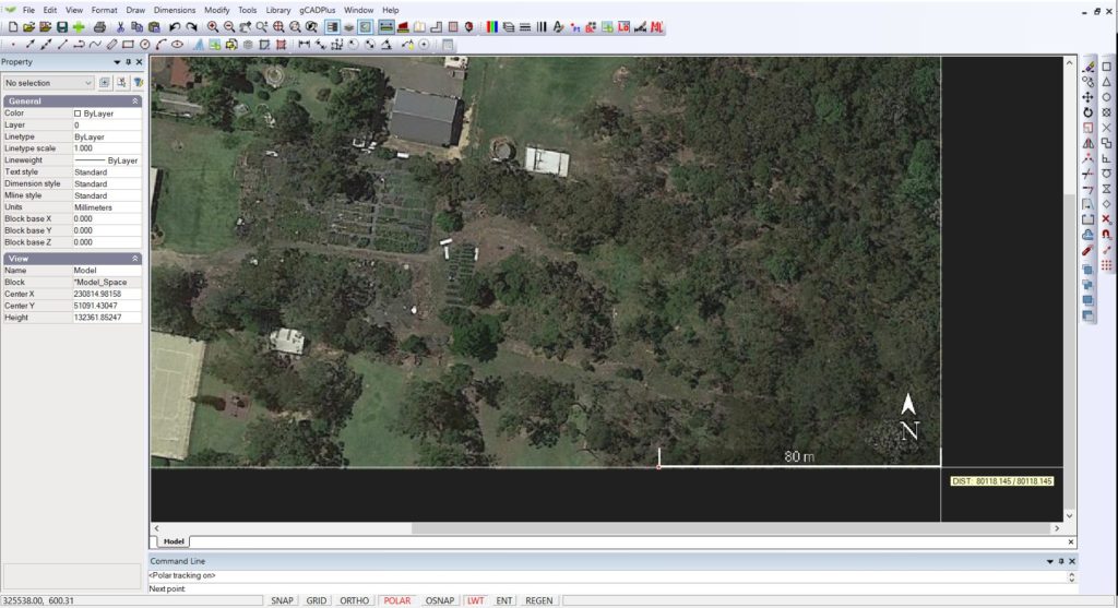
Once that’s done, we have a full-size base plan to work with and begin drawing.
Capture an image and develop contours using Google Earth.
It is possible to use Google Earth and ‘fly’ to a site and some CAD tools to create a set of reasonably accurate contours of satellite images of the site. Google Earth Pro is free software that, albeit not a valid GIS, allows visualisation, assessment, overlay, and geospatial data creation. This user-friendly resource is often a valuable intermediary for learners interested in learning more about GIS and wanting to start with more basic processes and tools.
This approach can significantly assist landscape designers in creating a base plan ready for the landscape plan proper.
Step 1. Install Google Earth Pro
Tip: Google Earth has two versions: the free version and Google Earth Pro. You need to download and install Google Earth Pro rather than the free version for serious landscape CAD work.
Google Earth Pro works on Windows, Macs, and Linux computers. Click here to learn more about Google Earth Pro and how to install it.
https://support.google.com/earth/answer/21955?hl=en
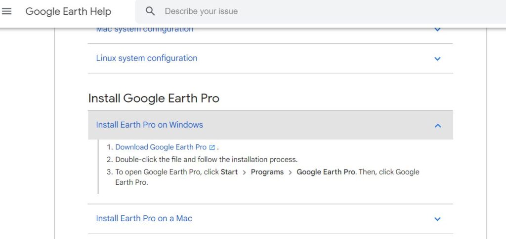
If you follow the instructions above, Google Earth Pro should install easily.