Drawing each design element at full size is most important when using CAD software such as gCADPlus to create landscape plans. That means that on completion of the design, it should be possible to mount a distance query in modelspace that returns the same value as if you were measuring on site. If working in the metric system, the distance reported would usually be in mm, while in the Imperial USA system, the base unit is decimal feet.
Applying dimensions in landscape plans is simple—the dimensions, whether linear, radial, or angular, are taken automatically from the CAD drawing. This serves as a critical check on the accuracy of your design.
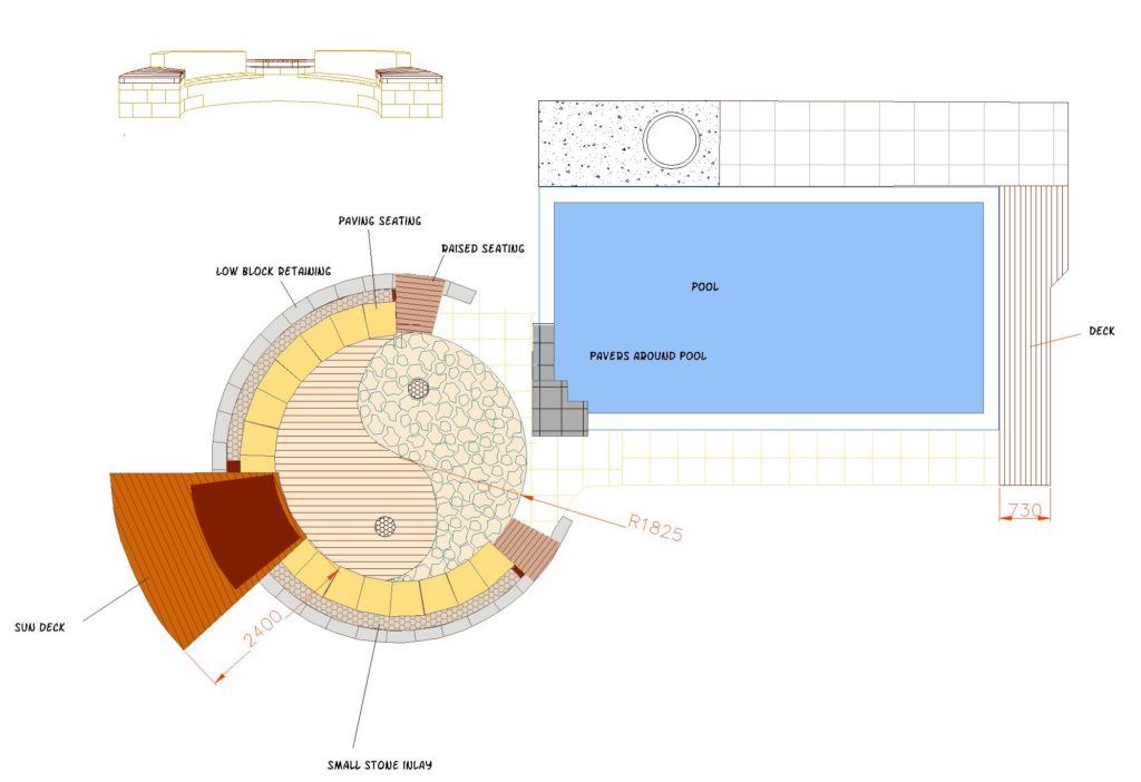
![]() Applying dimensions to a landscape design for a pool and its surrounds. We create a layer for dimensions, make that layer current and use linear, radial and aligned dimensions. Although not recommended, we show that it is possible to overtype dimensions and change a dimension value.
Applying dimensions to a landscape design for a pool and its surrounds. We create a layer for dimensions, make that layer current and use linear, radial and aligned dimensions. Although not recommended, we show that it is possible to overtype dimensions and change a dimension value.